OLD ORDNANCE SURVEY MAPS
For London
 This is our largest and most popular series, a massive group covering the central London area. In many
cases we have published maps in 2, 3 or even 4 different editions,
showing an area at different dates, typically 1872, 1894 and 1914.
This makes it possible to put the maps side by side and
see how the area changed over those years.
We have provided a series of Index Maps for most of the London maps.
This is our largest and most popular series, a massive group covering the central London area. In many
cases we have published maps in 2, 3 or even 4 different editions,
showing an area at different dates, typically 1872, 1894 and 1914.
This makes it possible to put the maps side by side and
see how the area changed over those years.
We have provided a series of Index Maps for most of the London maps.
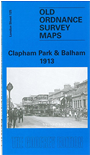
Most maps in the Godfrey Edition are taken from the 25 inch to the mile map and reduced to about 15 inches to the mile.
They cost just £ 3.00 each (Coloured editions £ 3.50). For a full list of English maps, return to the England page
You can order maps direct from our On-line Mapshop. They are also available from various
local outlets.
Alan Godfrey Maps, Prospect Business Park, Leadgate, Consett, DH8 7PW. Tel 01207 583388
The Godfrey Edition / sales@alangodfreymaps.co.uk / 10 August 2020
 ; 1914