
 Here are the details of maps for NW Croydon :

This detailed map covers a busy area of Croydon, stretching from West Croydon station northward to Pawsons Road.
The many features include Croydon Workhouse, West Croydon station, St James church, organ building works, tramways, London Road area, St George's church, St Michael & All Angels church, Christ Church, St Mary's RC church, St Saviour's church, General Hospital, Waddon Marsh Farm, Croydon Union Infirmary, smallpox hospital, etc. We include entries from a 1934 street directory on the reverse.
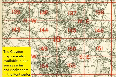
The map links up with London sheets 149 Thornton Heath to the north, 155 Croydon NE to the east, 157 Croydon to the south. Other maps are available in our Surrey series.
 Follow this link for a complete list of our London maps .