
 Here are the details of maps for Richmond:

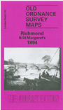
We have published just the one map for this area. The map covers the centre of Richmond, together with the St Margaret's area on the west side of the Thames, together with part of Twickenham, including Cambridge Park and Twickenham Park. It covers an area from London Road and Cole's Bridge eastward to Richmond station, and from Honywood Road and Richmond Green southward to Cambridge Park. Features on the Richmond side include the riverside area, Richmond Bridge, Buccleuch House, Town Hall, most of Richmond station, George Street, Lancaster Park; features on the St Margarets Side include Cambridge House, St Margarets House (Naval Female School), Old River Crane, Ivy Bridge. Street directories for George Street, The Green, Grosvenor Road, Hill Street, Hill Rise, King Street, Petersham Road, Vineyard are given on the reverse.
See also the Richmond 1911 map in our Surrey series, on somewhat different sheetlines.
The map links up with London Sheets 96 Isleworth to the north, 109 Whitton to the west, 111 Richmond Hill to the east, and 122 Twickenham to the south.