
Old Ordnance Survey Maps of London
These detailed maps maps normally cover an area of about one and a half miles by one mile. Each map includes an introduction. The London maps link up with those for Middlesex to form a major series for the Greater London area. They
are available through our On-line Mapshop
 Here are the details of maps for Notting Hill:
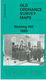
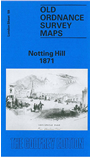
London Sheet 59.1 Notting Hill 1871 - published 1990; intro by Pamela Taylor. ISBN.978-0-85054-294-3  London Sheet 59.2 Notting Hill 1893 - published 1997; intro by Pamela Taylor. ISBN.978-0-85054-880-8
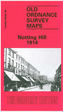
London Sheet 59.3 Notting Hill 1914 - published 1986; intro by Brian Curle. ISBN.978-0-85054-059-8
London Sheet 59.2 Notting Hill 1893 - published 1997; intro by Pamela Taylor. ISBN.978-0-85054-880-8
London Sheet 59.3 Notting Hill 1914 - published 1986; intro by Brian Curle. ISBN.978-0-85054-059-8
We have published three versions of this map, showing how the area developed across the years. The maps each cover the same
area, from White City eastward to Pembridge Square and St Stephen's Square, and capture the area of Kensington known as Notting Hill. In the NE is a portion of
Paddington parish, including Westbourne Park station; to the west is a portion of Hammersmith parish, rural in the early map but later developed to include White City. The area
developed considerably over the years, so brief notes about each map are given below:
The 1871 map (actually largely surveyed in 1863-5) shows the Ladbroke Estate already largely developed around Ladbroke Grove, Lansdowne Crescent, Ladbroke Square, Kensington Park
Road and other well set out streets. The area was previously known as Notting Dale or 'The Kensington Potteries'. amela Taytlor explains how this development
took place. Further west development is less complete and beyond Latimer Road there are still farms. Several railways run through the map: the West London Junction Railway, the
Hammersmith & City Railway, with Notting Hill station, and a small section of the GWR with Westbourne Grove station and engine sheds. At the north of the map is more countryside with
Portobello Farm and Notting Barn. Extreme top right is Paddington Workhouse.
The 1894 map shows Notting Hill entirely built up, with streets and houses as far as Latimer Road, which now has a station. Features include Mary Place Workhouse, Phoenix Brewery,
Avondale Park, Kensington Public Baths, St Charles RC College, Franciscan Convent,
Carmelite Convent, St Quintin Park, St Quintin & Wormwood Scrubbs station. Beyond the West London Railway is an area of
brickfields and (apparently) piggeries. On the reverse are street directories for Ladbroke Grove, Ladbroke Square and Lancaster Road.
The 1914 map shows the area further developed, with tramways and Wood Lane station. The main new development in the SW area of the map is the Olympic Stadium and the Great White City
complex built for the Shepherds Bush Exhibition. Nearbyis part of the Central London Railway Depot.
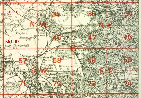
The map links up with
London Sheets 47 Kensal Green to the north, 58 East Acton to the west, 60 Paddington to the east,
73 Holland Park to the south.
 Follow this link for a complete list of our London maps .
You can order maps direct from our On-line Mapshop.
For other information and prices, and other areas, go to The Index Page.
Follow this link for a complete list of our London maps .
You can order maps direct from our On-line Mapshop.
For other information and prices, and other areas, go to The Index Page.
Maps in the Godfrey Edition are taken from the 25 inch to the mile map and reduced to about 15 inches to the mile.
For a full list of maps for England, return to the England page.
Alan Godfrey Maps, Prospect Business Park, Leadgate, Consett, Co Durham, DH8 7PW /
sales@alangodfreymaps.co.uk / 22 February 2018
 Follow this link for a complete list of our London maps .