Wiltshire County Council was formed in 1889. With reorganisation in 1974 it became a two-tier county with 5 districts: Kennet, North Wiltshire, Salisbury, Thamesdown, and West Wiltshire.
In 1997 Thamesdown became a unitary authority and was renamed Swindon. In 2009 the other 4 districts were abolished and Wiltshire also became a unitary authority.
See This Page for a summary of Wiltshire's local government history.
These are the maps we publish for Wiltshire:
Sheet 08.15 Malmesbury 1919 - published 2006; intro by Barrie Trinder
Sheet 11.02 Highworth 1922- published 2022; intro by Tony Painter
298 SE Wiltshire 1892 - published 1999; intro by Alan Godfrey. Includes a map of Wylye
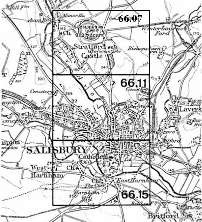
314 Cranborne Chase 1894 - published 2010; intro by Tony Painter. Includes a map of Berwick St John.
Most maps in the Godfrey Edition are taken from the 25 inch to the mile map and reduced to about 15 inches to the mile.
For a full list of English maps, return to the England page
This list shows all our maps for the area. We try to keep a full range in print but inevitably some titles fall out of print from time to time.
These are noted in our On-line Mapshop.Alan Godfrey Maps, Prospect Business Park, Leadgate, Consett, DH8 7PW. Tel 01207 583388
The Godfrey Edition / sales@alangodfreymaps.co.uk / 17 May 2023
 These are the maps we publish for Wiltshire:

