
 These are our maps for Malmesbury:
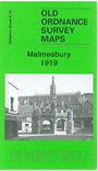
Wiltshire Sheet 8.15 Malmesbury 1919 - published 2006; intro by Barrie Trinder. ISBN.978-1-84151-935-9 
This detailed map covers the ancient town of Malmesbury, described by Barrie Trinder as a "hill-top town of a kind more commonplace in Italy". It was a place of importance in King Alfred's time, a centre of trade in the 15th and 16th centuries, and the birthplace of Thomas Hobbes in 1588. However it declined in importance in the 19th century and had a population of just 2,407 by the time of this map. We show it in detail, with features including the town centre, Horsefair, station, Cross Hayes, High Street, Abbey church, Holloway Bridge, Winyard Mill, silk mill, Mill Brewery, malthouses. Coverage extends south to Burton Hill and Burtonhill House. Eastward is a stretch of the GWR Malmesbury branch, and Cowbridge House. We also include a commercial directory of the town in 1907 and a timetable for the railway branch in 1929.