Old Ordnance Survey Maps of Wiltshire

  • These detailed maps normally cover an area of about one and a half miles by one mile. Each map includes an introduction.
  • They are available through our On-line Mapshop

  • Here are details of maps for Westbury:

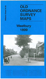
    Wiltshire Sheet 44.08 Westbury 1899 - published 2014; intro by Tony Painter. ISBN.978-1-84784-780-5

    This detailed map covers the small Wiltshire town of Westbury; the town centre is shown in detail and coverage just extends NW to the station.

    Features include All Saints church, Angel Mill, Bitham Mill, Bereswell, Market Place, Town Hall, chapels, cemetery, Prospect Square, Eden Vale, Westbury & Whorwellsdown Workhouse, brick works, station, Westbury Iron Works (in extreme NW corner) etc. A 1907 directory is included on the reverse.


  • Follow this link for a complete list of our Wiltshire Series or Swindon maps; or here for all maps in South West England.
  • You can order maps direct from our On-line Mapshop. For other information and prices, and other areas, go to The Index Page.
  • Most maps in the Godfrey Edition are taken from the 25 inch to the mile map and reduced to about 15 inches to the mile. For a full list of maps for England, return to the England page.
    The Godfrey Edition / sales@alangodfreymaps.co.uk / 12 January 2018