
Old Ordnance Survey Maps of Surrey
This list covers Surrey maps in Outer London.
The maps are all taken from the OS 25" maps and reduced to a scale of approximately 15 inches to the mile.
They are extremely detailed, showing individual houses, details such as railway tracks, pathways,
pubs, factories and even minutiae such as fountains and signal posts. Each map includes an introduction.
All maps are available from our On-line Mapshop.
There is a separate page for the towns in the present county of Surrey. For them go to this page.
 These are the detailed Surrey maps available for outer London, especially Croydon, Merton and Sutton boroughs:
06.04 Richmond 1911 - published 2017; intro by Pamela Taylor
06.08 Petersham 1910 - published 2018; intro by Pamela Taylor
06.12 Ham 1911 - published 2018; intro by Pamela Taylor
06.16 Kingston upon Thames 1895 - published 2013; intro by Richard Oliver
07.13 Coombe & Norbiton 1911 - published 2013; intro by Richard Oliver
12.03 Hampton Court & East Molesey 1912 - published 2006; intro by Alan Godfrey
12.04 North Surbiton & South Kingston 1932 - published 2011; intro by Alan Godfrey
12.07 Thames Ditton 1895 - published 2011; intro by Alan Godfrey
12.08 Surbiton & Long Ditton 1912 - published 2012; intro by Alan Godfrey
13.01 New Malden 1911 - published 2018; intro by Richard Oliver
13.02 Raynes Park & West Barnes 1933 - published 2018; intro by Richard Oliver
13.03 Morden 1894 - published 2008; intro by Pamela Taylor
13.04 Mitcham 1910 - published 2012; intro by Richard Oliver
13.08 Beddington Corner 1894 - published 1998; intro by John W Brown
13.11 Sutton (North) 1910 - published 2012; intro by Richard Oliver
13.12 Carshalton & North Wallington 1910 - published 2012; intro by Richard Oliver
13.13 Ewell (West) 1910 - published 2012; intro by Richard Oliver
13.14 Cheam, Ewell (E) & Nonsuch Park 1910 - published 2012; intro by Richard Oliver
13.15 Sutton 1895 - published 1999; intro by John W Brown
13.16 Carshalton (South) 1895 - published 2002; intro by John W Brown
14.02 Thornton Heath 1911 - published 1997; intro by John W Brown
14.05 Croydon (Mitcham Road) 1911 - published 1998; intro by John W Brown
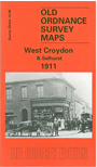
14.06 West Croydon & Selhurst 1911 - published 1998; intro by Oliver Harris
14.07 Croydon (Woodside) 1911 - published 1998; intro by Allison Pattison
14.09 Beddington & Waddon 1911 - published 1998; intro by John W Brown
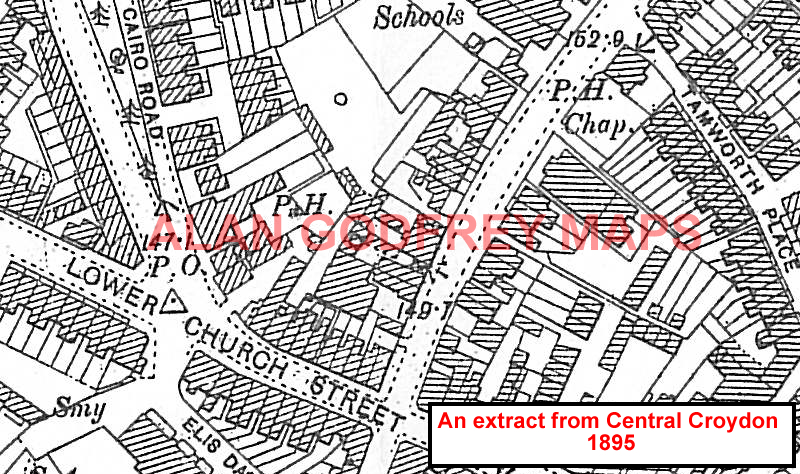
14.10 Central Croydon 1895 - published 1993; intro by Oliver Harris
14.11 Shirley 1911 - published 1998; intro by Colin Williamson
 14.13 South Beddington 1911 - published 1998; intro by John W Brown
14.14 South Croydon 1895 - published 1994; intro by John Gent
20.01 Purley 1910 - published 1999; intro by Alan Godfrey & Roger Packham
20.02 Purley Oaks 1895 - published 1997; intro by Allison Pattison
20.11 Warlingham 1910 - published 1995; intro by Richard Oliver
20.14 Coulsdon Common 1895 - published 2001; intro by John W Brown
14.13 South Beddington 1911 - published 1998; intro by John W Brown
14.14 South Croydon 1895 - published 1994; intro by John Gent
20.01 Purley 1910 - published 1999; intro by Alan Godfrey & Roger Packham
20.02 Purley Oaks 1895 - published 1997; intro by Allison Pattison
20.11 Warlingham 1910 - published 1995; intro by Richard Oliver
20.14 Coulsdon Common 1895 - published 2001; intro by John W Brown
Many other maps for the northern part of this area, including parts of Norwood, Thornton Heath etc, are
in our London Series.
Also in the Godfrey Edition, some of our One Inch to the Mile maps cover part of the county.
See the One Inch page for further details of this
series. The principal maps for the county, together with other maps in todays' County of Surrey, are listed on
this page.
Maps in today's County of Surrey are listed on the Surrey page.
 Most maps in the Godfrey Edition are taken from the 25 inch to the mile map and reduced to about 15 inches to the mile.
For a full list of English maps, return to the England page
Most maps in the Godfrey Edition are taken from the 25 inch to the mile map and reduced to about 15 inches to the mile.
For a full list of English maps, return to the England page
Alan Godfrey Maps, Prospect Business Park, Leadgate, Consett, DH8 7PW. Tel 01207 583388
The Godfrey Edition / sales@alangodfreymaps.co.uk / 10 April 2018
 14.13 South Beddington 1911 - published 1998; intro by John W Brown