Old Ordnance Survey Maps of Surrey

  • These detailed maps normally cover an area of about one and a half miles by one mile. Each map includes an introduction.
  • They are available through our On-line Mapshop

  • Here are the details of the map for Petersham:

  • Surrey Sheet 06.08 Petersham 1910 - published 2018; intro by Pamela Taylor. ISBN.978-1-78721-123-0

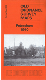
    This detailed map covers the village of Petersham, south of Richmond.

    Features include Petersham village with individual buildings neatly shown, Petersham Park, Petersham Common, Kidney Wood, St Peter's church, Star & Garter Hotel, Mansion Hotel, All Saints church, Pembroke Lodge, Sudbrook Park, Sidmouth Wood, Whiteash Lodge, Bailiff's Cottage, Ham House, Beaufort House. also Orleans House and Marblehill on the Middlesex bank of the Thames.

    The map links up with sheet 6.04 Richmond to the north and 6.12 Ham to the south.


  • Follow this link for a complete list of our Surrey maps, here for Richmond, or here for Kingston.
  • You can order maps direct from our On-line Mapshop. For other information and Prices, see Index Page.
  • Most maps in the Godfrey Edition are taken from the 25 inch to the mile map and reduced to about 15 inches to the mile.
    The Godfrey Edition / sales@alangodfreymaps.co.uk / 16 February 2018