Old Ordnance Survey Maps of County Down
We have a small range of detailed maps for Co Down towns, and we also cover the whole county at the Inch to the Mile scale.
All maps are available from our On-line Mapshop.
 These are the detailed maps currently available for eastern Belfast:
Sheet 04.08 Sydenham & Strandtown 1902 - published 1999, intro by John Griffiths
Sheet 04.11 Belfast (East) 1902 - published 1997, intro by Barbara Morris
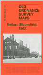
Sheet 04.12 Belfast (Bloomfield) 1902 - published 1999, intro by John Griffiths
Sheet 05.09 Belfast (Knockdene Park) 1902 - published 1999, intro by John Griffiths
Sheet 05.10 Dundonald 1902 - published 1999, intro by Peter Carr
 And these are for other towns in County Down:
Sheet 01.13 Holywood 1931 - published 1988, intro by Alison McCloy
Sheet 02.05 Bangor (West) 1901 - published 1995, intro by Trevor McCavery
Sheet 02.06 Bangor (East) 1901 - published 1995, intro by Trevor McCavery
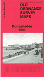
Sheet 03.09 Donaghadee 1901 - published 1995, intro by Deirdre Armstrong
Sheet 06.09 Newtownards 1901 - published 1995, intro by Trevor McCavery
Sheet 27.13 Banbridge 1903 - published 2012, intro by Alan Godfrey
Sheet 46.16 Newry 1903 - published 2006, intro by Alan Godfrey
Town plans Downpatrick 1901 - published 1986.
 The county is also covered in our Inch to the Mile series. These are the principal maps for the county:
Sheet 29 Belfast Lough 1901 - published 2009. Includes a detailed map of Groomsport.
Sheet 36 Belfast & Hillsborough 1901 - published 2009. Includes a detailed map of Hillsborough.
Sheet 37 Comber & Saintfield 1900 - published 1992. Includes detailed maps of Comber and Saintfield.
Sheet 47 Armagh, Tandragee & District 1900 - published 2010.
Sheet 48 Banbridge & Dromore 1900 - published 2010. Includes a detailed map of Waringstown.
Sheet 49/50 Downpatrick, Portaferry & Ballynahinch 1899 - published 2009. Includes a detailed map of Ballynahinch.
Sheet 60 The Mourne Mountains 1900 - published 2014. Includes a detailed map of Castlewellan.
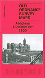
Sheet 61 Ardglass & Dundrum Bay 1900 - published 2009. Includes a detailed map of Ardglass.
Sheet 71 Carlingford Lough 1900 - published 2010.
 Most maps in the Godfrey Edition are taken from the 25 inch to the mile map and reduced to about 15 inches to the mile.
For a full list of Irish maps, return to the Ireland page
You can order maps direct from our On-line Mapshop.
Most maps in the Godfrey Edition are taken from the 25 inch to the mile map and reduced to about 15 inches to the mile.
For a full list of Irish maps, return to the Ireland page
You can order maps direct from our On-line Mapshop.
Alan Godfrey Maps, Prospect Business Park, Leadgate, Consett, DH8 7PW. Tel 01207 583388
The Godfrey Edition / sales@alangodfreymaps.co.uk / 14 January 2018