 Here are the details of maps for Bangor (West):

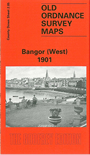
This very detailed map is one of a pair for Bangor and covers the west of the town; coverage extends from Main Street westward to Carnalea House, and from St Comgall's RC church northward to the shore and Wilson's Point.
Features include railway terminus, Royal Belfast Golf Links, Bryansburn, Brunswick Road area, Maxwell Road area, Mornington Park, Smelt Mill Bay, Sandy Row, Old and New Piers, Royal Hotel, Burlington Hotel, Grand Hotel, Pickie Rock, Town Hall, etc. On the reverse we include directory extracts, including a list of inhabitants, entries A-H.
The map links up with sheet 2.06 Bangor East to the east.