 Here are the details of maps for Belfast (East):

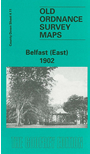
This very detailed map covers part of east Belfast, east of the Lagan. Note that the Co Antrim area west of the Lagan is left blank. Coverage stretches from Albert Bridge and Ormeau Park eastward to Castlereagh Road, and from Newtownards Road southward to Ravenhill Avenue.
Features include many crowded streets of terraces, Ormeau Park, Cromac Distillery, Lagan Engine Works, Albert Bridge, Queen's Bridge (at top margin), Chemical Manure Works, Cromac Brewery, tramways and Mountpottinger depot, St Ann's Iron Works, Belfast Felt Works, Willowfield House, Loopbridge Weaving Factory, jam factory, Castlereagh Laundry, Loopbridge Printing Works, Avoneil Distillery, St Patrick's church, Nettlefield, Ravenhill Presbyterian church, St Clement's church etc. On the reverse we include street directory entries for Albertbridge Road, Castlereagh Street, Ravenhill Road, Ravensdale Street, Templemore Avenue.
The map links up with sheet 4.12 Bloomfield to the east.