
 Here are the details of maps for Downpatrick:
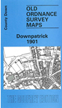
This detailed map includes all three Town Plans for Downpatrick, reduced in scale to 24 inches to the mile. The map is double-sided, with sheets 2-3 on the main side, sheet 1 on the reverse. This was the first map we published in Ireland and so is not standard with other maps in the series..
Most of the town centre is shown on the main side and features on sheets 2-3 include town centre, station, Cathedral, Infantry Barrack, Court House, Ardmore, markets, St Patrick's RC church, St Margaret's church, Irish Street, Market Street, English Street, Infirmary etc. On the reverse sheet 1 covers the northern part of the town including starch works and Rathkeltar. There is no introduction, but a 1900 directory of inhabitants is included.