
Old Ordnance Survey Maps of Devon
These detailed maps normally cover an area of about one and a half miles by one mile. Each map includes an introduction.
They are available through our On-line Mapshop
Both Devonport and Plymouth became County Boroughs in 1889, but they, together with East Stonehouse Urban District, merged as Plymouth County Borough in 1914.
This became the City of Plymouth in 1928. There was a reorganisation in 1974, with a county council and ten Districts, of which Plymouth was one. However, in 1998
Plymouth and Torbay both became unitary authorities once again.
See This Page for a summary of Devon's local government history.
 These are the maps we publish for Plymouth:
123.03 Devonport NW 1933 - published 2025; intro by Tony Painter
123.04 Plymouth NW (Peverell & Mannamead) 1912 - published 2025; intro by Tony Painter
123.07a Devonport North 1893 - published 2001; intro by Richard Oliver
123.07b Devonport North 1933 - published 2025; intro by Tony Painter
123.08a Plymouth North 1893 - published 2000; intro by Richard Oliver
123.08b Plymouth North 1912 - published 2025; intro by Tony Painter
123.11a Devonport South & Stonehouse 1893 - published 2001; intro by Richard Oliver
123.11b Devonport South & Stonehouse 1912 - published 2024; intro by Tony Painter
123.12a Plymouth Hoe 1892 - published 1999; intro by Richard Oliver
123.12b Plymouth Hoe 1912 - published 2024; intro by Tony Painter
124.02 Plympton St Mary 1933 - published 2025; intro by Richard Oliver
124.03 Plympton St Maurice 1933 - published 2025; intro by Richard Oliver
124.05 Plymouth (Laira) 1912 - published 2024; intro by Richard Oliver
124.09 Plymouth (Oreston & Cattedown) 1912 - published 2024; intro by Richard Oliver
Go to the Devon page for other towns in the county.
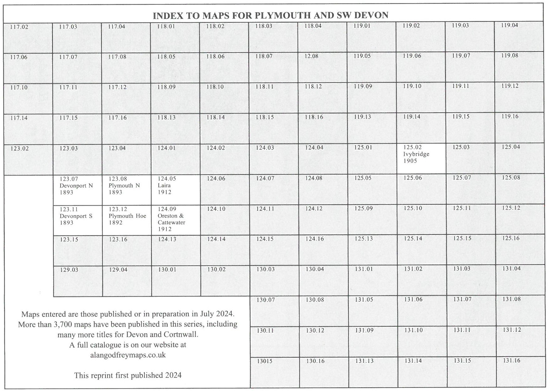
Here is an index grid of the Plymouth maps.
Devon is also covered in our Inch to the Mile series. This is the principal sheet for Plymouth:
348 Plymouth to Polperro 1894 - published 2005; intro by Tom Greeves. Includes a map of Polperro
For full details of this series go to the One Inch page.
 Most maps in the Godfrey Edition are taken from the 25 inch to the mile map and reduced to about 15 inches to the mile.
For the rest of Devon go to the Devon page, for Torbay to the Torbay page.
For a full list of English maps, return to the England page
Most maps in the Godfrey Edition are taken from the 25 inch to the mile map and reduced to about 15 inches to the mile.
For the rest of Devon go to the Devon page, for Torbay to the Torbay page.
For a full list of English maps, return to the England page
This list shows all our maps for the area. We try to keep a full range in print but inevitably some titles fall out of print from time to time.
These are noted in our On-line Mapshop.
Alan Godfrey Maps, Prospect Business Park, Leadgate, Consett, DH8 7PW. Tel 01207 583388
The Godfrey Edition / sales@alangodfreymaps.co.uk / 13 June 2025