Old Ordnance Survey Maps of Devon

  • These detailed maps normally cover an area of about one and a half miles by one mile. Each map includes an introduction.
  • They are available through our On-line Mapshop

  • Here are the details of maps for Plymouth Laira:

  • Devon Sheet 124.05 Plymouth (Laira) 1912 - published 2024; intro by Richard Oliver. ISBN.978-1-78721-794-2

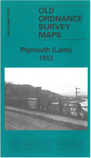
    This map covers the eastern part of Plymouth around Laira and Mount Gold.

    Features include Borough Hospital, Mount Gold, St Simon's church, River Plym, The Laira, St Mary & All Saints church, Saltram Farm, Chelson Meadow, race course; railways incl Laira Junction, Laira Yard, Lipson Junction, Mount Gold Junction, Friary Junction, engine shed, Yealmpton Branch, Cattewater Junction; Plymouth & Dartmoor Tramway, Saltram Point etc. We include an introduction by Richard Oliver and extracts from a 1906 directory.

    The map links up with sheet 123.08 Plymouth North to the west, 124.09 Oreston to the south.


  • Follow this link for a list of our maps for Devon county, Plymouth, or Torbay; or here for a general list for the South West. For other information and prices, and other areas, go to The Index Page.
  • Maps in the Godfrey Edition are taken from the 25 inch to the mile map and reduced to about 15 inches to the mile. For a full list of maps for England, return to the England page.
    Alan Godfrey Maps, Prospect Business Park, Leadgate, Consett, Co Durham, DH8 7PW / sales@alangodfreymaps.co.uk / 17 September 2024