
 Here are the details of the map for the Camden Lock area:

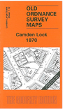
This very detailed map at a 'Yard to the Mile' scale covers the area around Camden Lock. Features include the North London Railway with Camden Town station, Camden Bridge, College Street Bridge, Regents Canal, Brecknock Crescent, Camden Brewery, Hawley Lock, Hampstead Road Lock, Rochester Square, organ works, part of Kentish Town Road. Coverage stretches from Hartland Road eastward to Stratford Place, and from Lyme Street northward to Rochester Road.
The map links up with London Large Scale Sheet 7.02 Kentish Town to the north, 7.11 Chalk Farm to the west, 7.13 New Camden Town to the east, 7.22 Camden Town to the south.