Old Ordnance Survey Town Plans of London

  • These highly detailed maps, at a scale of 1:1760 or a Yard to the Mile, cover parts of central London in exceptional detail. They are available through our On-line Mapshop

  • Here are the details of the map for Kentish Town:

  • London Large Scale Sheet 07.02 Kentish Town 1870-94 - published 2024. Intro by Pamela Taylor. ISBN.978-1-78721-755-3

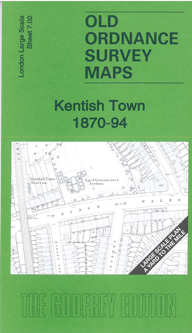
    This very detailed map covers the centre of Kentish Town, either side of Kentish Town Road.

    Features include Midland Railway with Kentish Town station, Camden Road station, St Luke's church, short stretch of Hampstead Junction Railway with Kentish Town station, Aged Governesses Asylum, chapels, color works etc.

    The map links up with sheet 7.01 Kentish Town West to the west, 7.12 Camden Lock to the south.


  • For other Town Plans go to the London Town Plans page. Here is an Index Grid
  • For a full list of maps for London and Middlesex, return to the London page.
  • For other information and prices, and other areas, go to The Home Page.
    Alan Godfrey Maps, Prospect Business Park, Leadgate, Consett, DH8 7PW. Tel 01207 583388
    The Godfrey Edition / sales@alangodfreymaps.co.uk / 24 June 2024