Old Ordnance Survey Maps of Essex
All maps are available from our On-line Mapshop or from selected bookshops in the area.
The following maps are all taken from the OS 25" maps and reduced to a scale of approximately 15 inches to the mile.
They are extremely detailed, showing individual houses, details such as railway tracks, pathways,
pubs, factories and even minutiae such as fountains and signal posts. Each covers an area of a mile by a mile and a half. Each map includes an introduction. For further details click on the links below.
I have divided Essex into two groups. This page covers those towns in the old GLC area, in the boroughs of Barking & Dagenham, Havering, Newham, Redbridge and Waltham Forest, the so-called 'London-in-Essex'. Further maps for parts of this area are in
our London series. For maps outside London go to the Essex county page.
See This Page for a summary of the county's local government history.
 These are the detailed maps currently available for 'Essex-in-London' (or 'London-in-Essex'):
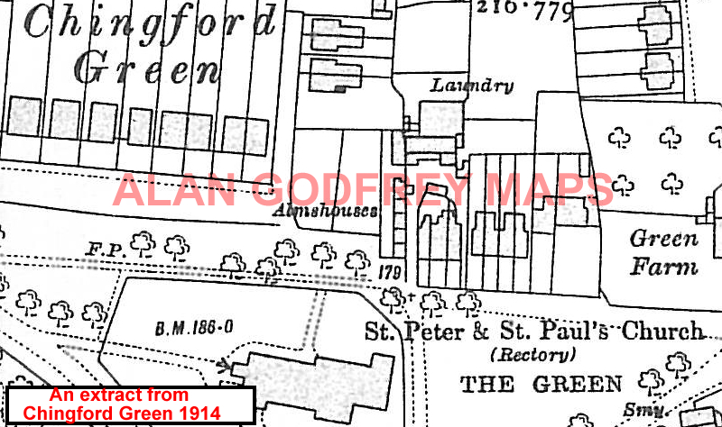
69.09n Chingford Green 1914 - published 1998; introduction by Alan Godfrey
69.10n Buckhurst Hill 1914 - published 2000; intro by Alan Godfrey
69.1n3 Chingford Hatch 1914- published 2008; intro by Alan Godfrey
69.14n Woodford Wells 1914- published 2008; intro by Alan Godfrey
69.15n Chigwell Station 1914 - published 2005; intro by Tony Cliffrord
69.16n Chigwell Row & Grange Hill 1914 - published 2004; intro by Tony Clifford
74.01 Seven Kings 1894 - published 1995; intro by Tony Clifford
74.09 Barking & Upney 1897- published 1994; intro by Tony Clifford
78.01na Highams Park & Hale End 1914- published 2008; intro by Alan Godfrey
78.01nb Walthamstow North & Highams Park 1940- published 2020; intro by Alan Godfrey
78.02n Woodford 1915- published 2008; intro by Alan Godfrey
78.08n Aldborough Hatch 1914 - published 1999; intro by Alan Godfrey
78.12n Newbury Park & Seven Kings 1914 - published 1999; intro by Tony Clifford
78.16n Goodmayes 1915 - published 1998; intro by Tony Clifford
79.09n Chadwell Heath 1914 - published 1993; intro by Tony Clifford
79.10n Romford 1916 - published 1996; intro by Tony Clifford
79.11n Heath Park & Emerson Park 1915 - published 1997; intro by Tony Clifford
79.13n Becontree Heath & Valence House 1914 - published 1993; intro by Tony Clifford
79.14n Rush Green 1914 - published 1994; intro by Tony Clifford
79.15n Hornchurch 1915 - published 2002; intro by Tony Clifford
79.16n Upminster 1915 - published 2016; intro by Alan Godfrey
 86.04na Upney 1915 - published 1998; intro by Tony Clifford
86.04nb Barking (Upney) 1939 - published 2006; intro by Tony Clifford
86.07n East Ham & Barking (South) 1915 - published 2007; intro by Tony Clifford & Alan Godfrey
87.01n Parsloes 1915 - published 1994; intro by Tony Clifford
87.02n Dagenham 1915 - published 1993; intro by Tony Clifford
86.04na Upney 1915 - published 1998; intro by Tony Clifford
86.04nb Barking (Upney) 1939 - published 2006; intro by Tony Clifford
86.07n East Ham & Barking (South) 1915 - published 2007; intro by Tony Clifford & Alan Godfrey
87.01n Parsloes 1915 - published 1994; intro by Tony Clifford
87.02n Dagenham 1915 - published 1993; intro by Tony Clifford
The following pages list the Essex and London maps available for individual London boroughs:
London Borough of Barking & Dagenham
London Borough of Havering
London Borough of Newham
London Borough of Redbridge
London Borough of Waltham Forest
Also in the Godfrey Edition, much of this area is covered by a smaller scale, Inch to the Mile map: Romford & SW Essex 1893 .
 Most maps in the Godfrey Edition are taken from the 25 inch to the mile map and reduced to about 15 inches to the mile.
For a full list of English maps, return to the England page
You can order maps direct from our On-line Mapshop. They are also available from various
local outlets.
Most maps in the Godfrey Edition are taken from the 25 inch to the mile map and reduced to about 15 inches to the mile.
For a full list of English maps, return to the England page
You can order maps direct from our On-line Mapshop. They are also available from various
local outlets.
Alan Godfrey Maps, Prospect Business Park, Leadgate, Consett, DH8 7PW. Tel 01207 583388
The Godfrey Edition / sales@alangodfreymaps.co.uk / 4 July 2020
>