Old Ordnance Survey Maps of Essex

  • These detailed maps maps normally cover an area of about one and a half miles by one mile. Each map includes an introduction. The Essex maps link up with those for London to form a major series for the Greater London area. They are available through our On-line Mapshop

  • Here are the details of maps for Buckhurst Hill:

  • Essex (New Series) 69.10 Buckhurst Hill 1914 - published 2000; intro by Alan Godfrey. ISBN.978-1-84151-141-2

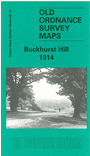
    This detailed map covers much of Buckhurst Hill village, extending westward to Crescent Road and northward to Warren Hill.

    Features include Buckhurst Hill station, Baldfaced Stag pub, Buckhurst Hill House, Rigg's Retreat, part of Epping Forest, Whitehall Nursery, Devon House, St John's church, Reindeer pub, Warrenwood House pub, Royal Forest Hotel, Queen Elizabeth's Hunting Lodge, Roebuck Hotel, Oak Hall etc. An 1895 directory of Buckhurst Hill is included on the reverse.

    The map links up with Essex Sheets 69.09 Chingford Green to the west and 69.14 Woodford Wells to the south.


  • Follow this link for a list of our maps for the London Borough of Waltham Forest, or here for a complete list of our 'Essex-in-London' maps .
  • You can order maps direct from our On-line Mapshop. For other information and prices, and other areas, go to The Index Page.
  • Maps in the Godfrey Edition are taken from the 25 inch to the mile map and reduced to about 15 inches to the mile. For a full list of maps for England, return to the England page.
    Alan Godfrey Maps, Prospect Business Park, Leadgate, Consett, Co Durham, DH8 7PW / sales@alangodfreymaps.co.uk / 26 October 2017