Old Ordnance Survey Maps of London

  • These detailed maps maps normally cover an area of about one and a half miles by one mile. Each map includes an introduction. The Essex maps link up with those for London to form a major series for the Greater London area. They are available through our On-line Mapshop

  • Here are the details of maps for Chingford Hatch:

  • Essex (New Series) 69.13 Chingford Hatch 1914 - published 2008; intro by Alan Godfrey. ISBN.978-1-84784-130-8

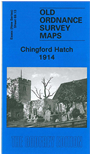
    This detailed map covers Chingford Hatch together with Chingford Mount, an area being developed in 1914. Coverage stretches from Bateman Road northward to the Old Church and eastward to Chingford Hatch. Features include the Chingford Branch railway (but no stations), St Edmunds church (the original one), tramway, St Peter & St Paul's church (the 'Old Church'), Chingford Mount Cemetery, Suffield Hatch, Isolation Hospital, Higham Farm, part of Highams Park, Larks Hall Farm, Cherrydown Farm, Normanshire Farm, Nightingale Hall etc. On the reverse we include a commercial directory for Chingford.

    The map links up with Essex Sheet 69.09 Chingford Green to the north, 69.14 Woodford Wells to the east and and London Sheet 4 Edmonton SE to the west.


  • Follow this link for a list of our maps for the London Borough of Waltham Forest, or here for a complete list of our 'Essex-in-London' maps .
  • You can order maps direct from our On-line Mapshop. For other information and prices, and other areas, go to The Index Page.
  • Maps in the Godfrey Edition are taken from the 25 inch to the mile map and reduced to about 15 inches to the mile. For a full list of maps for England, return to the England page.
    Alan Godfrey Maps, Prospect Business Park, Leadgate, Consett, Co Durham, DH8 7PW / sales@alangodfreymaps.co.uk / 26 October 2017