
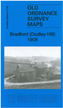
 Here are the details of maps for Bradford Dudley Hill:

This detailed map covers the area from Bowling southward to Tong Street and eastward to Holme village.
Features include railway with Dudley Hill station, tramways, Victoria Incline, Goose Hill, Victoria Brick Works, Terry's Mills, Perseverance Mills, Victoria Dye Works, Albion Mill, Albion Dye Works, iron foundry, St John's church, industrial tramways, Tong Colliery, Prospect Mill, Montserrat Mills, Stanley Mills, Holme Shay etc. On the reverse we include street directory entries for Cutler Heights, Rooley Lane, Tong Street.
The map links up with sheets 216.12 Bradford South to the west, 217.05 Bradford East to the north, 217.13 East Bierley to the south, 217.10 Tong to the east.