
 Here are the details of maps for Bradford (S):

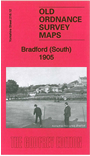
This detailed and busy map covers the south part of Bradford, including West Bowling and part of East Bowling.
Features include Bowling Park, GNR railway with Bowling Junction and station, Bowling Cemetery, Bowling Hall, Staygate, Newhall, Bowling Dye Works, Woodroyd Brick Works, Rooley, Woodroyd House, tramways, Prospect Mills, St Matthew's church, Bankfoot Mills, Craven Heifer Inn, Rooley Hall, Chapel Green, Briggella Mills, Holme Top Mills Towers Hall, St Stephen's church, St Stephen's Shed, schools, Bowling Soap Works, Parkside Mills, chapels, library, Woodroyd Shed etc. A selection of street directory entries is included on the reverse.
The map links up with sheet 216.08 Bradford to the north, 216.11 Bradford (Great Horton) to the west, 217.09 Dudley Hill to the east.