Old Ordnance Survey Maps of Surrey

  • These detailed maps normally cover an area of about one and a half miles by one mile. Each map includes an introduction.
  • They are available through our On-line Mapshop

  • Here are the details of maps for Byfleet:

  • Surrey Sheet 17.03 Byfleet & Brooklands (South) 1912 - published 2024; intro by Tony Painter. ISBN.978-1-78721-782-9

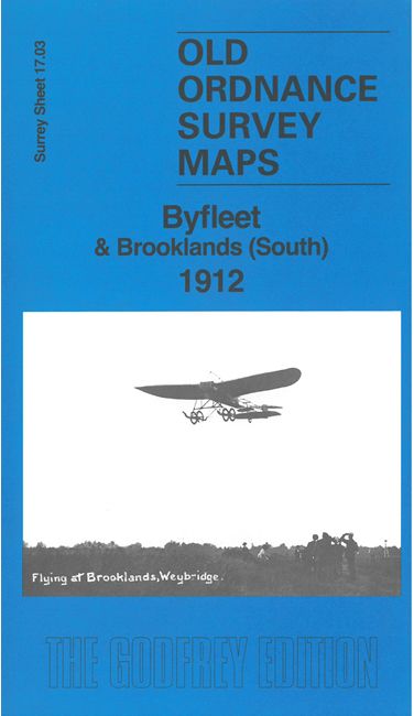
    This map links up with sheet 11.15 to the north to complete coverage of the historic Brooklands race course and 'Aviation Ground'. It also includes the village of Byfleet. Other features include the Basingstoke Canal, Clock House, Village Hall, and numerous detached houses.

    On the reverse we include 1903 and 1934 directories of Byfleet together with a specially written introduction to the history of the area.

    The map links up with sheet 11.15 Brooklands to the north.


  • Follow this link for a complete list of our Surrey maps, here for Croydon, or here for the London Boroughs. For other information and Prices, see Index Page.
  • Most maps in the Godfrey Edition are taken from the 25 inch to the mile map and reduced to about 15 inches to the mile.
    The Godfrey Edition / sales@alangodfreymaps.co.uk / 30 August 2024