
 Here are the details of the map for the King's Cross area:

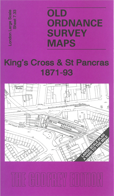
This highly detailed map at a 'Yard to the Mile' scale is dominated by St Pancras and King's Cross stations. Each is shown in detail, with the full track layout and even the interior layout of station buildings. Coverage on the map extends from Seymour Street eastward to North Street, and from Wharfdale Road southward to Manchester Street. Other features include Home & Colonial Society's School, St Jude's church, King's Cross Metropolitan station, Argyle Square, Imperial Gas Works, St Pancras School, The Polygon, Christ Church Chalton Street. On the reverse we include the 1894 version of the same map, at a slightly reduced scale; this shows Somers Town Goods Depot and King's Cross suburban station.
The map links up with Sheets 7.23 Old St Pancras to the north, 7.32 Euston to the west, 7.34 Pentonville to the east, 7.43 North Bloomsbury to the south.