Kent 8.03 Blackfen & Danson Park 1931 - published 2022; intro by Pamela Taylor. ISBN.978-1-78721-503-0 
This detailed map covers the area around Blackfen and Danson Park, west of Bexleyheath.
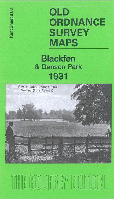
Features include Blendon (in SE corner), Danson Park, The Lake, southern part of Welling, Westwood Farm,
Selwyn Crescent, Queen's Wood, St John's church, Rochester Way etc.
The map links up with
Kent Sheets 2.15 East Wickham to the north, 8.04 Bexleyheath to the east,
8.07 Lamorbey to the south.
For other maps in Bexley see our Bexley page.
Follow this link for a complete list of our London Series maps or this for a list of the Kent Series maps.
You can order maps direct from our On-line Mapshop.
For other information and prices, go to The Index Page.
Maps in the Godfrey Edition are taken from the 25 inch to the mile map and reduced to about 15 inches to the mile.
For a full list of maps for London, return to the London page
The Godfrey Edition / sales@alangodfreymaps.co.uk / 29 December 2021

 Here are the details of maps for Blackfen and Danson Park: