
 Here are the details of maps for Atherton (NE):

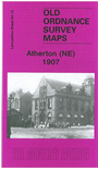
This highly detailed map covers the NE part of Atherton, and southern part of Westhoughton around the Pretoria Pit.
Features include a stretch of the Lancashire & Yorkshire Railway with Atherton Central station, Peelwood Colliery with rail branch; Pretoria Pit (here called Hulton Colliery Nrs 3 and 4 Pits), scene of the terrible disaster in 1910; tramways, New Brook House, Laburnum Mill, Atherton Town Hall, Victoria Mills etc. On the reverse we include a railway timetable for the Wigan-Manchester line in 1914.
The map links up with sheets 94.08 Hulton Park to the north, 94.11 Daisy Hill to the west, 95.09 Little Hulton to the east and 94.16 Tyldesley to the south.