
Old Ordnance Survey Maps of Enfield
We have very good coverage for the London Borough of Enfield, which was formed in 1965 from the Municipal Boroughs of Edmonton, Enfield and Soutgate.
The area includes maps from both our London and Middlesex series, which link up with each other.
The following titles are all taken from the OS 25" maps and reduced to a scale of approximately 14 inches to the mile.
They are extremely detailed, showing individual houses, details such as railway tracks, pathways,
pubs, factories and even minutiae such as fountains and signal posts. Each covers an area of a mile and
a half by one mile, and includes an introduction. All maps
are available from our On-line Mapshop.
 These are the detailed maps for Enfield in our London series:
1a Lower Edmonton 1894 - published 1998; intro by Alan Godfrey
1b Lower Edmonton 1936 - published 2020; intro by Pamela Taylor
2a Edmonton (Pickett's Lock) 1894 - published 1998; intro by Alan Godfrey
2b Edmonton (Pickett's Lock) 1935 - published 2022; intro by Pamela Taylor
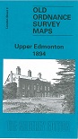
3a Upper Edmonton 1894 - published 1998; intro by Alan Godfrey
3b Upper Edmonton 1936 - published 2020; intro by Pamela Taylor
4a Edmonton (SE) 1894 - published 1998; intro by Alan Godfrey
4b Edmonton SE & Chingford SW 1936 - published 2022; intro by Pamela Taylor
These are the detailed maps for Enfield in our Middlesex series:
01.08 Potters Bar (North) & Littleheath 1896 - published 1995; intro by David Mander
02.12 see Hertfordshire 41.12 Waltham Cross 1896
02.15 Enfield (Forty Hill & Clay Hill) 1935 - published 2021; intro by Pamela Taylor
02.16 Enfield Wash 1910 - published 2010; intro by Pamela Taylor
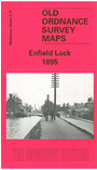
03.13 Enfield Lock 1895 - published 200; intro by Alan Godfrey
 07.02 Enfield (NW) 1911 - published 2010; intro by Pamela Taylor
07.03a Enfield (North) 1895 - published 1995; intro by Alan Godfrey
07.03b Enfield (North) 1935 - published 2021; intro by Pamela Taylor
07.04 Enfield Highway 1911 - published 1995; intro by Alan Godfrey
07.06a Enfield Chase 1895 - published 2010; intro by Pamela Taylor
07.06b Enfield Chase 1936 - published 2021; intro by Pamela Taylor
07.07a Enfield (South) 1895 - published 1999; intro by Alan Godfrey
07.07b Enfield (South) 1935 - published 2021; intro by Pamela Taylor
07.08a Ponders End 1895 - published 1999; intro by Alan Godfrey
07.08b Ponders End 1936 - published 2021; intro by Pamela Taylor
07.09 East Barnet & Southgate 1896 - published 1992; intro by Gillian Gear & Pamela Taylor
07.10a Winchmore Hill 1896 - published 1987; intro by Peter Hodge
07.10b Winchmore Hill 1936 - published 2020; intro by Pamela Taylor
07.13 Friern Barnet & New Southgate 1898 - published 1987; intro by Pamela Taylor
07.14a Palmers Green 1912 - published 1992; intro by Graham Dalling
07.14b Palmers Green 1936 - published 2020; intro by Pamela Taylor
07.02 Enfield (NW) 1911 - published 2010; intro by Pamela Taylor
07.03a Enfield (North) 1895 - published 1995; intro by Alan Godfrey
07.03b Enfield (North) 1935 - published 2021; intro by Pamela Taylor
07.04 Enfield Highway 1911 - published 1995; intro by Alan Godfrey
07.06a Enfield Chase 1895 - published 2010; intro by Pamela Taylor
07.06b Enfield Chase 1936 - published 2021; intro by Pamela Taylor
07.07a Enfield (South) 1895 - published 1999; intro by Alan Godfrey
07.07b Enfield (South) 1935 - published 2021; intro by Pamela Taylor
07.08a Ponders End 1895 - published 1999; intro by Alan Godfrey
07.08b Ponders End 1936 - published 2021; intro by Pamela Taylor
07.09 East Barnet & Southgate 1896 - published 1992; intro by Gillian Gear & Pamela Taylor
07.10a Winchmore Hill 1896 - published 1987; intro by Peter Hodge
07.10b Winchmore Hill 1936 - published 2020; intro by Pamela Taylor
07.13 Friern Barnet & New Southgate 1898 - published 1987; intro by Pamela Taylor
07.14a Palmers Green 1912 - published 1992; intro by Graham Dalling
07.14b Palmers Green 1936 - published 2020; intro by Pamela Taylor
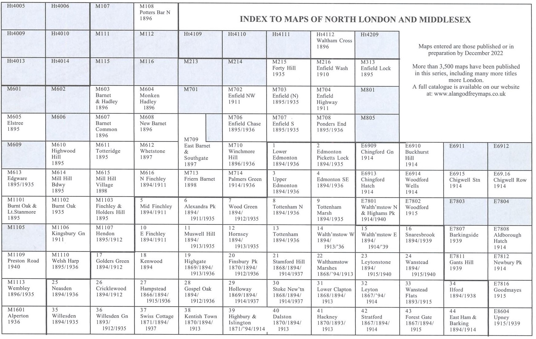
Here is a North London index grid.
 Most maps in the Godfrey Edition are taken from the 25 inch to the mile map and reduced to about 15 inches to the mile.
For a full list of English maps, return to the England page
You can order maps direct from our On-line Mapshop.
Most maps in the Godfrey Edition are taken from the 25 inch to the mile map and reduced to about 15 inches to the mile.
For a full list of English maps, return to the England page
You can order maps direct from our On-line Mapshop.
Alan Godfrey Maps, Prospect Business Park, Leadgate, Consett, DH8 7PW. Tel 01207 583388
The Godfrey Edition / sales@alangodfreymaps.co.uk / 17 November 2022