

 Here are the details of maps for Enfield (S):

We have published two versions of this map, showing how the area changed across the years. Each covers the southern end of Enfield, an area from Church Street, Market Place and Enfield Town station southward to Bushhill House.
Features on the map include the GER Enfield Branch including Bushhill Park station, Bushhill Tower, Bush Hill, New River, Lincoln Road, Southbury Road, Old Park.
The map links up with Middlesex Sheets 7.03 Enfield North to the north, 7.06 Enfield Chase to the west, 7.08 Ponders End to the east, and London Sheet 1 Lower Edmonton to the south.
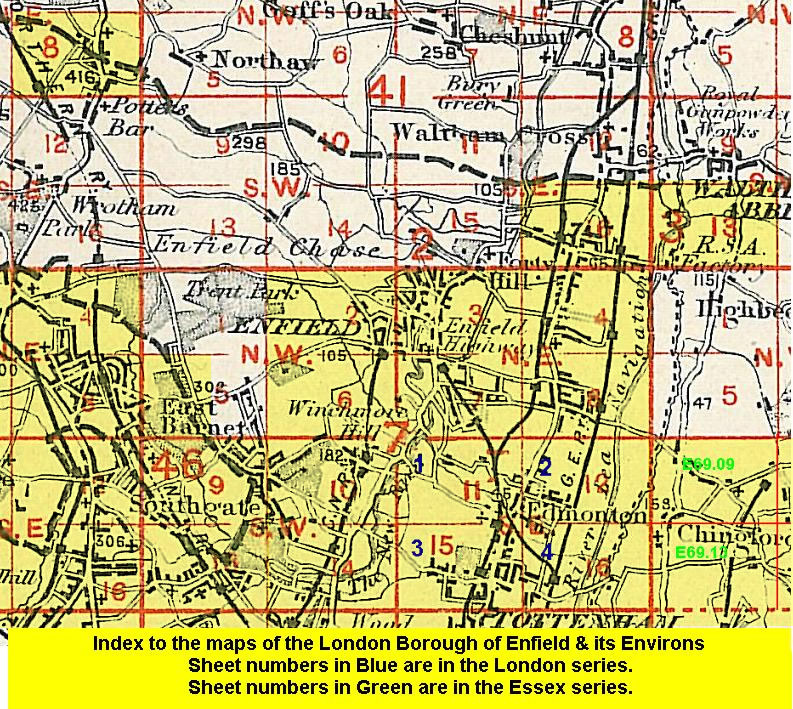 Follow this link for a list of our maps for the London Borough of Enfield, or here for a complete list of our London maps .