
 Here are the details of maps for Glasshoughton and Castleford:

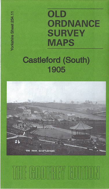
This detailed map covers the southern part of Castleford, including the station, together with Glasshoughton.
Features include NER railway with station, Lancashire & Yorkshire Railway with its station (later renamed Cutsyke), All Saints church Hightown, cricket ground, Half Acres, Theatre Royal, Beancroft area, Smawthorne area, Perseverance Brewery, St Joseph's RC church, Castleford Bottle Works, Aire & Calder Bottle Works, tramway (partly built), Queen's Park, Red Hill, St Paul's church, Glasshoughton village, Glashoughton Colliery with sidings etc, Old Corpse Road, Round Hill area, various potteries, Cutsyke, NER Cutsyke Branch etc.
The map links up with sheet 234.07 Castleford to the north and 234.10 Whitwood to the west.