Old Ordnance Survey Maps of Leeds

  • These detailed maps normally cover an area of about one and a half miles by one mile. Each map includes an introduction.
  • They are available through our On-line Mapshop

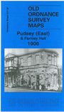
  • Here are the details of maps for Pudsey (East):

  • Yorkshire Sheet 217.07 Pudsey (East) & Farnley Hall1906 - published 2009; intro by Ruth Strong. ISBN.978-1-84784-307-4

    This detailed map coversthe eastern part of Pudsey with coverage extending from Robin Lane and Littlemoor Road eastward to Farnley Hall and from Park Spring Quarry southward to Crowther Farm.

    Features include Troy Dale, Acres Hall, Farnley Hall, Farnley Park, St Michael & All Angels church, Lawns House, Park Spring, Troydale Leather Works, Kent area, Roker Lane, Southroyd Mill, Littlemoor Bottom area, Spencer Row, Alma Tannery, gas works etc.


    The map links up with sheet 217.03 Bramley to the north, 217.11 Farnley Moor Top to the south, 217.06 Pudsey to the west and 217.08 Wortley to the east.


  • Follow this link for a complete list of our Bradford or Leeds area maps; or here for the whole Yorkshire series. You can order maps direct from our On-line Mapshop. For other information and prices, and other areas, go to The Index Page.
  • Most maps in the Godfrey Edition are taken from the 25 inch to the mile map and reduced to about 15 inches to the mile.
    For a full list of maps for England, return to the England page.
    Alan Godfrey Maps, Prospect Business Park, Leadgate, Consett, Co Durham, DH8 7PW / sales@alangodfreymaps.co.uk / 8th August 2017