 Here are the details of maps for South Kenton:

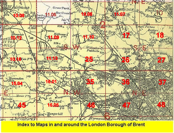
This detailed map covers parts of Wembley and Harrow, with coverage stretching from Paxford Road northward to Northwick Avenue, and from Peterborough Road eastward to Grasmere Avenue.
Features include Northwick Park Golf Course, football grounds, Harrow School Bathing Place, LMS railway with South Kenton station, Metropolitan Railway with Northwick Park station, Chewing Gum Factory etc. We include a selection of street directory entries on the reverse, incl Abbots Drive, Carlton Avenue West, Northwick Avenue, The Fairway, The Ridgeway.
The map links up with Middlesex Sheet 10.08 Kenton to the north, 11.09 Preston Road to the east, 10.11 Harrow on the Hill to the west, 10.16 Sudbury to the south.
 Follow this link for a list of our maps for the London Borough of Brent, or here for a complete list of our London maps .