
 Here are the details of maps for Stanmore:

This map covers the village of Great Stanmore, with coverage stretching from Elms Road eastward to Stanmore 'underground' station. Features include the LMS station, St John's church, Stanmore Park, Gordon Avenue, Manor House, many detached villas, Cottesmore, etxc. Coverage extends northward to Stanmore Hall Farm. We include a 1933 Stanmore directory on the reverse.
The map links up with Middlesex Sheets 5.15 Harrow Weald to the west and 6.13 Edgware to the east.
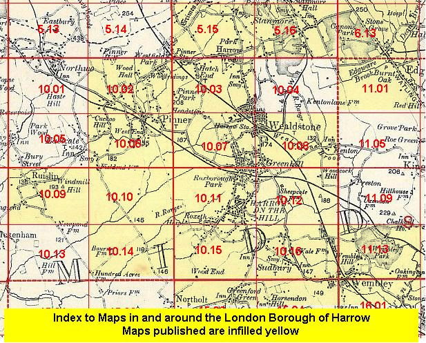 Follow this link for a list of our maps for the London Borough of Harrow, or here for a complete list of our London maps .