
 Here are the details of the map for the South Bloomsbury area:

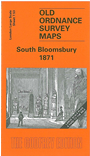
This highly detailed map at a 'Yard to the Mile' scale covers an area of south Bloomsbury, with coverage stretching from Tottenham Court Road eastward to Red Lion Square, and from Great Ormond Street southward to New Oxford Street. The dominant feature is the British Museum, shown here in splendid detail, even including much interior layout detail (Roman Gallery, Grenville Library etc); Other features include Bloomsbury Square, St George's church Hart St, Russell Square, St George the Martyr's church, Queen Square, Trinity church Little Queen St, Bedford Square, Torrington Square, Horseshoe Brewery, Great Russell Street. On the reverse we include street directory entries for Bedford Square, Bloomsbury Square, Gt Ormond Street, Gt Russell Street, Keppel Street, Montague Place and Square, Museum Street, Queen Square, Russell Square, Southampton Row and Street.
The map links up with Sheets 7.43 North Bloomsbury to the north, 7.52 Langham Place to the west, 7.63 Covent Garden to the south.