Old Ordnance Survey Town Plans of London

  • These highly detailed maps, at a scale of 1:1760 or a Yard to the Mile, cover parts of central London in exceptional detail. They are available through our On-line Mapshop

  • Here are the details of the map for Belsize Park:

  • London Large Scale Sheet 06.10 Belsize Park 1866-94 - published 2025. Intro by Pamela Taylor. ISBN.978-1-78721-857-4

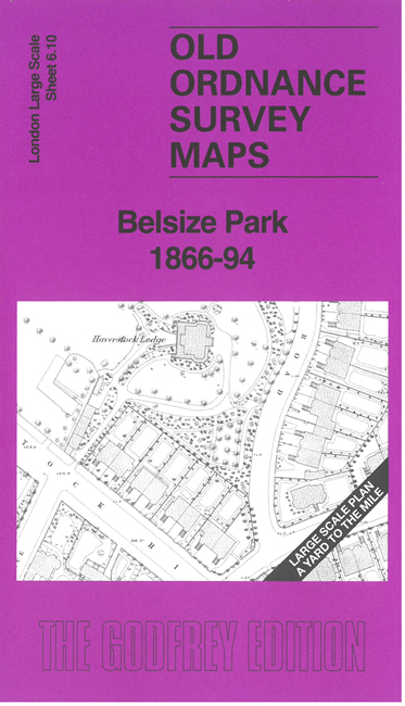
    This very detailed map covers Belsize Park, which was being developed as a residential area in the late 19th century. Features on the 1866 map include Haverstock Lodge, Belsize Farm, St Peter's church, Highfield House, Woodlands, Hillfield. The 1866 map is so detailed that even garden layouts are shown for many houses. Some streets of housing were still under development at the time but are shown more complete on the 1894 map and the introduction by Pamela Taylor explains the historical background.

    The map links up with sheet 7.01 Kentish Town West to the east

  • For other Town Plans go to the London Town Plans page. Here is an Index Grid
  • For a full list of maps for London and Middlesex, return to the London page.
  • For other information and prices, and other areas, go to The Home Page.
    Alan Godfrey Maps, Prospect Business Park, Leadgate, Consett, DH8 7PW. Tel 01207 583388
    The Godfrey Edition / sales@alangodfreymaps.co.uk / 1 May 2025