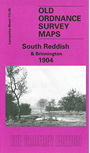
 Here are the details of maps for Reddish (South):

This detailed map is split between Lancashire and Cheshire, with the River Tame, forming much of the boundary, snaking down the centre of the map. The Lancashire side is the more interesting, including the Reddish Road area, with coverage stretching from Reddish Green southward to South Reddish and Willow Grove cemetery. Features include a short stretch of the Stockport to Guide Bridge railway with Reddish station, Reddish Hall, Yew Tree Farm, South Cliff, printing works, Hanover Mills, Hammond House, Albert Mill, White Hill Farm, St Mary's church, Reddish Vale Print Works. On the Cheshire side is a rural part of Brinnington, incl stretches of railway with no stations, Manor House. On the reverse we include a selection of street directories, incl Bedford Street, Broadstone Road, Greg Street, Reddish Road, Reddish Vale.
The map links up with Lancashire Sheets 112.01 North Reddish to the north, 111.08 Heaton Chapel to the west, 112.06 Woodley to the east, and 112.09 Stockport North to the south.