Old Ordnance Survey Maps of Buckinghamshire
We have a range of detailed maps for Buckinghamshire towns and we also cover the whole county at the Inch to the Mile scale.
Here are the details.
All maps are available from our On-line Mapshop.
Buckinghamshire County Council was formed in 1889. There was a reorganisation in 1974, with a county council and five districts: Aylesbury Vale,
Chiltern, Milton Keynes, South Bucks, and Wycombe. Slough and Eton were transferred to Berkshire. Milton Keynes became a unitary authority in 1997 and its maps are also listed here.
See This Page for a summary of the county's local government history.
 These are the maps we publish for Buckinghamshire:
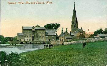
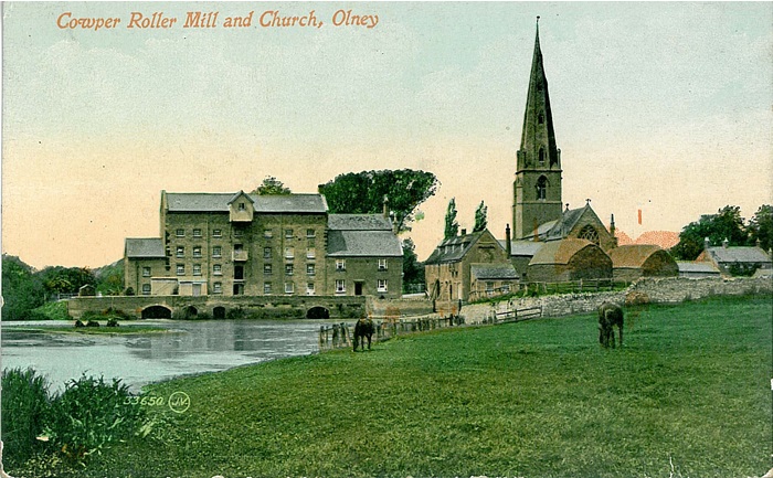
02.15 Olney 1899 - published 2007; intro by Barrie Trinder
09.10 Stony Stratford & Old Wolverton 1898 - published 1997; intro by Alan Godfrey
09.11 Old Wolverton 1898 - published 2022; intro by Barrie Trinder
09.12a Wolverton & New Bradwell 1880 - published 1993; intro by Moira Courtman
09.12b Wolverton & Stantonbury 1898 - published 2022; intro by Barrie Trinder
10.02 Newport Pagnell 1899 - published 1993; intro by Edward Legg
13.10 Buckingham 1938 - published 2005; intro by Barrie Trinder
15.10 Fenny Stratford & Bletchley 1924 - published 1993; intro by Edward Legg
19.10 Winslow 1923 - published 2022; intro by Barrie Trinder
28.16 Aylesbury 1923 - published 1994; intro by Julian Hunt
37.07 Princes Risborough 1897 - published 2022; intro by Tony Painter
39.09 Chesham 1923 - published 2006; intro by Pamela Taylor
43.05 Amersham 1897 - published 1994; intro by Elizabeth Lockwood
47.01a High Wycombe 1897 - published 1994; intro by Elizabeth Lockwood
47.01b High Wycombe 1923 - published 2022; intro by Barrie Trinder
47.08 Beaconsfield (West) 1923 - published 2022, intro by Tony Painter
48.09 Beaconsfield (East) 1923 - published 2022; intro by Tony Painter
52.01 Marlow 1897 - published 1994; intro by Elizabeth Lockwood
53.13 Slough Trading Estate 1932 - published 2022; intro by Barrie Trinder
56.02a Slough 1897 - published 1993; intro by Judith Hunter
56.02b Slough 1932 - published 2022; intro by Barrie Trinder
56.05 Eton & Eton Wick 1899 - published 1994; intro by Judith Hunter
58.08 Staines 1894 - published 2024; intro by Mike Jee
The following come under our Bedfordshire series:
Bedfordshire 28.10a Leighton Buzzard & Linslade 1879 published 2022; intro by Tony Kirby  Bedfordshire 28.10b Leighton Buzzard & Linslade 1900 published 1994; intro by Alan Godfrey
We also cover Buckinghamshire in our Inch to the Mile series. These are the principal sheets for the county:
202 Towcester & District 1899 - published 2003, intro by Barrie Trinder; includes a map of Blisworth
203 Bedford & District 1895 - published 2001, intro by Barry Stephenson; includes a map of Turvey
219 Buckingham & District 1887 - published 2006; intro by Barrie Trinder. Includes a map of Stowe Park
220 South Bedfordshire 1893 - published 2007; intro by Barrie Trinder. Includes a map of Aspley Heath
237 Thame & District 1886 - published 2000, intro by Elizabeth Lockwood; includes a map of Brill
238 North Chilterns 1888 - published 1997, intro by Alan Godfrey; includes a map of Aldbury
254 South Oxfordshire 1887 - published 2003, intro by Tony Painter; includes a map of Dorchester-on-Thames
255 South Chilterns 1886 - published 1997, intro by Elizabeth Lockwood; includes a map of Chalfont St Peter
269 Windsor Forest & District 1897 - published 1998, intro by Christopher Board; includes a map of Stanwell
Visit the One Inch page for a full list of Inch to the Mile maps.
 Most maps in the Godfrey Edition are taken from the 25 inch to the mile map and reduced to about 15 inches to the mile.
For a full list of English maps, return to the England page
You can order maps direct from our On-line Mapshop.
This list shows all our maps for the area. We try to keep a full range in print but inevitably some titles fall out of print from time to time.
These are noted in our On-line Mapshop.
Most maps in the Godfrey Edition are taken from the 25 inch to the mile map and reduced to about 15 inches to the mile.
For a full list of English maps, return to the England page
You can order maps direct from our On-line Mapshop.
This list shows all our maps for the area. We try to keep a full range in print but inevitably some titles fall out of print from time to time.
These are noted in our On-line Mapshop.
Alan Godfrey Maps, Prospect Business Park, Leadgate, Consett, DH8 7PW. Tel 01207 583388
The Godfrey Edition / sales@alangodfreymaps.co.uk / 7 February 2024
 These are the maps we publish for Buckinghamshire: