Old Ordnance Survey Inch to the Mile Maps

  • These maps normally cover an area of about 18 miles by 12 miles and are especially good at showing railways, roads and canals, and at giving a broad view of a wider area. Each includes an introduction and a more detailed map of a small town or village. They are available through our On-line Mapshop

  • Here is information about Sheet 220:

  • One Inch Sheet 220 South Bedfordshire 1893 - published 2007; intro by Barrie Trinder. ISBN.978-1-84151-990-6

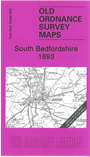
    This map covers a broad swathe of south Bedfordshire, plus a portion of Buckinghamshire. Coverage stretches from Wing eastward to Luton, and from Ampthill southward to Dunstable. Other towns include Bletchley, Fenny Stratford and Leighton Buzzard. Features include Woburn with Woburn Park, the railway from Leighton Buzzard to Luton, Mentmore Park, Liscombe Park, Wrest Park. The NW corner of the map is now part of Milton Keynes. On the reverse we include a map of Aspley Heath.


    It is not possible to list the many hamlets, farmsteads and other topographical features shown on these maps. However, you may find it useful if we list the towns and principal villages or church parishes that are included on this map:

  • Bedfordshire: Ampthill, Aspley Guise, Aspley Heath, Barton in the Clay, Battlesden, Billington, Chalgrave, Clophill, Dunstable, Eaton Bray, Eversholt, Flitton, Greenfield, Harlington, Heath & Reach, Higham Gobion, Hockliffe, Houghton Regis, Husborne Crawley, Leagrave, Leighton Buzzard, Lower Gravenhurst, Luton, Maulden, Milton Bryant, Potsgrove, Pulloxhill, Ridgemont, Silsoe, Stanbridge, Steppingley, Streatley, Sundon, Tilsworth, Tingrith, Toddington, Totternhoe, Westoning, Woburn.
  • Buckinghamshire: Aston Abbots, Bletchley, Bow Brickhill, Cublington, Drayton Parslow, Dunton, Edlesborough, Fenny Stratford, Great Brickhill, Grove, Linslade, Little Brickhill, Loughton, Mentmore, Newton Longville, Shenley Brook End, Shenley Church End, Simpson, Slapton, Soulbury, Stewkley, Stoke Hammond, Walton, Wavendon, Wing, Woburn Sands, Woughton on the Green.
  • Hertfordshire: Caddington, Hexton.

    Index maps are available showing the areas covered by the Inch to the Mile maps. Go to This page


    You can order maps direct from our On-line Mapshop. For a full list of Inch to the Mile maps go to the Inch to the Mile page, where you will also find details of prices. For information on the rest of the series, go to The Index Page.


    Alan Godfrey Maps, Prospect Business Park, Leadgate, Consett, Co Durham, DH8 7PW / sales@alangodfreymaps.co.uk / 16 April 2011