Old Ordnance Survey Maps of Buckinghamshire

  • These detailed maps normally cover an area of about one and a half miles by one mile. Each map includes an introduction.
  • They are available through our On-line Mapshop

  • Here are the details of maps for Marlow:

  • Buckinghamshire Sheet 52.01 Marlow 1897 - published 1994; intro by Elizabeth Lockwood. ISBN.978-0-85054-698-9

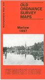
    This detailed map covers the town of Marlow, plus small portions of Cookham and Bisham parishes on the south side of the river. Features include Marlow town centre, Marlow Bridge, All Saints church, railway terminus, Cattle Market, High Street, Quoiting Square, Spital Street; Marefield and Holy Trinity church near top of map; Marlow Fields, Court Garden, Wethered's brewery. The 'Three Men in a Boat' stayed at the Crown Hotel here and refilled their larder in the town. Across the River Thames are Stoney Ware and Compleat Anglers Hotel (in Bisham parish) and Quarry Wood, Kings Coppice Farm, Dial Close (Cookham parish). A directory of Marlow is also included.


  • Follow this link for a complete list of our Buckinghamshire or Milton Keynes maps.
  • You can order maps direct from our On-line Mapshop. For other information and prices, and other areas, go to The Index Page.
  • Most maps in the Godfrey Edition are taken from the 25 inch to the mile map and reduced to about 15 inches to the mile. For a full list of maps for the Buckinghamshire region, return to the Thames & Chilterns page
    The Godfrey Edition / sales@alangodfreymaps.co.uk / 27 January 2018