
 Here is information about Sheet 158:
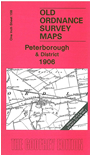
This One Inch to the Mile map covers the area around and to the NE of Peterborough, with coverage stretching from Helpston eastward to Guyhirne, and from Sutton St Edmund southward to Whittlesey. Other towns on the map are Crowland and Market Deeping, while on the reverse we include a detailed map of Deeping St James and Deeping Gate. Transport features include the Peterborough, Wisbech & Sutton Bridge Branch, the River Nene, while there is good depiction of the fens.
It is not possible to list the many hamlets, farmsteads and other topographical features shown on these maps. However, you might find it useful if we here list the majority of the principal villages and church parishes that are included on this map. Links are given for those for which detailed large-scale maps are also available.
Index maps are available showing the areas covered by the Inch to the Mile maps. Go to This page
You can order maps direct from our On-line Mapshop. For a full list of Inch to the Mile maps go to the Inch to the Mile page, where you will also find details of prices. For information on the rest of the series, go to The Index Page.