Old Ordnance Survey Inch to the Mile Maps

  • These maps normally cover an area of about 18 miles by 12 miles and are especially good at showing railways, roads and canals, and at giving a broad view of a wider area. Each includes an introduction and a more detailed map of a small town or village. They are available through our On-line Mapshop

  • Here is information about Sheet 62:

  • One Inch Sheet 62 Harrogate & District 1911 - published 2007; intro by John Gough. ISBN.978-1-84784-053-0

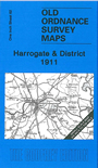
    This Inch to the Mile map covers the area around and to the east of Harrogate, with coverage stretching eastward to Easingwold, northward to Fountains Abbey. The map also includes Knaresborough and Boroughbridge. Features include Studley Royal, Aldborough, the closed railways north of Harrogate towards Ripon and Pilmoor, Ripley, Ribston Park, Newby Hall. On the reverse we include a detailed map of the small village of Burton Leonard, with directory.


    It is not possible to list the many hamlets, farmsteads and other topographical features shown on these maps. However, you may find it useful if we list the towns and principal villages or church parishes that are included on this map. Links are given for those for which detailed large-scale maps are also available.

  • Yorkshire: Aldborough, Aldwark, Allerton Mauleverer with Hopperton, Alne, Arkendale, Beningborough, Bilton, Bishop Monkton, Boroughbridge, Brafferton, Brearton, Bridge Hewick, Burton Leonard, Cattal, Coneythorpe & Clareton, Copgrove, Cowthorpe, Easingwold, Farnham, Ferrensby, Flawith, Flaxby, Follifoot, Goldsborough, Great Ouseburn, Great Ribston with Walshford, Green Hammerton, Harrogate, Helperby, Hunsingore, Ingerthorpe, Killinghall, Kirby Hall, Kirby Hill, Knaresborough, Langthorpe, Lindrick with Studley Royal & Fountains, Linton upon Ouse, Little Ouseburn, Little Ribston, Littlethorpe, Lower Dunsforth, Marton cum Grafton, Minskip, Moor Monkton, Myton on Swale, Newton upon Ouse, Nidd, North Deighton, Nun Monkton, Overton, Pannal, Ripley, Roecliffe, Rufforth, Scotton, Scriven, Shipton, Skelton, South Stainley with Cayton, Staveley, Studley Roger, Tholthorpe, Thorpe Underwoods, Tockwith, Tollerton, Upper Dansforth with Branton Green, Walkingham Hill with Occaney, Whixley, Widdington, Youlton.

    Index maps are available showing the areas covered by the Inch to the Mile maps. Go to This page


    You can order maps direct from our On-line Mapshop. For a full list of Inch to the Mile maps go to the Inch to the Mile page, where you will also find details of prices. For information on the rest of the series, go to The Index Page.


    Alan Godfrey Maps, Prospect Business Park, Leadgate, Consett, Co Durham, DH8 7PW / sales@alangodfreymaps.co.uk / 16 April 2011