
 Here is information about Sheets 49:
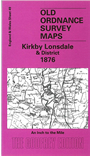
This One Inch to the Mile map covers southern Westmorland and smaller portions of Lancashire. Coverage stretches from Grange eastward to Kirkby Lonsdale and the slopes of Gragareth, crossing the Lune and Kent valleys; and from Oxenholme station southward to just north of Carnforth. On the reverse is a detailed map of the village of Beetham.
It is not possible to list the many hamlets, farmsteads and other topographical features shown on these maps. However, you may find it useful if we list the towns and principal villages or church parishes that are included on this map. Links are given for those for which detailed large-scale maps are also available.
Index maps are available showing the areas covered by the Inch to the Mile maps. Go to This page
You can order maps direct from our On-line Mapshop. For a full list of Inch to the Mile maps go to the Inch to the Mile page, where you will also find details of prices. For information on the rest of the series, go to The Index Page.