
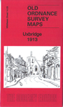
 Here are the details of maps for Uxbridge:
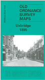

We have published two versions of this map, showing how the area changed across the years.
The maps cover the Middlesex town of Uxbridge. Coverage stretches from High Bridge along High Street, and southward to The Greenway; to the west, across the River Colne, are some acres of rural Buckinghamshire, including Sandstone, Gallow Hill Farm and Mansfield Farm. Features on the map include the GWR Uxbridge branch and terminus, the Grand Junction Canal, Fray's River, Uxbridge Moor, part of Hillingon West around Cowley Road, Rockingham Bridge and the narrow streets and alleys off the High Street. Extracts from early directories are included on the reverse.
The map links up with sheet 14.04 Hillingdon North to the east, 14.07 Cowley to the south.
 Follow this link for a list of our maps for the London Borough of Hillingdon, or here for a complete list of our London maps .