
 Here are the details of maps for Cowley:

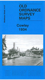
This detailed map covers the Middlesex village of Cowley, just south of Uxbridge. Please note that the Buckinghamshire area of the map is left blank.
Coverage stretches from Queen's Road southward to Cowley Crescent, and from the GWR railway westward to the county boundary. Features include Neptune Works, Grand Union Canal, Yiewsley Mill House, Old Mill House, Clisby's Bridge, Cowley House, GWR branch with Cowley station, Cowley Grove, Shovel Inn. On the reverse we include directories for Cowley in 1890 and 1933.
The map links up with sheet 14.03 Uxbridge to the north, 14.08 Hillingdon South to the east and 14.11 Yiewsley West to the south.
 Follow this link for a list of our maps for the London Borough of Hillingdon, or here for a complete list of our London maps .