
 Here are the details of maps for north Hillingdon:

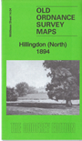
This detailed map covers the northern part of Hillingdon, around Hillingdon House, and also includes the eastern fringe of Uxbridge. Features include Hillingdon House and Hillingdon Court, both with large estates; Oak Farm, Court Farm, Hercies Farm, The Chestnuts, St Andrew's church, Montague House, Royal Standard and Green Man pubs, Polehill Lodge etc. A list of Hillingdon private residents from a directory of 1890 is included on the reverse.
The map links up with sheet 09.16 Ickenham to the north, 14.03 Uxbridge to the west and 14.08 Hillingdon South to the south.
 Follow this link for a list of our maps for the London Borough of Hillingdon, or here for a complete list of our London maps .