
 Here are the details of maps for Worsley:

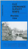
This detailed map covers Worsley and the area to the east, extending eastward to Folly Lane and northward to Ellesmere Street. It includes Hazelhurst, Deane, Moorside and Broadoak Park. Features include Bridgewater Canal, Worsley Yard and Basin, LNWR line with Worsley station, Bridgewater Collieries Railway with spur to canal, Old Warke Dam, Hazelhurst Hall, Drywood Hall, Sindsley, Broadoak Park, Bridgewater Hotel, Dales Brow, brass foundry, many villas, cotton mills etc. On the reverse we include a selection of street directory entries, incl Barton Road, Broad Oak Park and Road, Folly Lane, Hazelhurst, Moorside Road, Worsley Road.
The map links up with sheets 95.15 Wardley to the north, 103.02 Worsley to the west, 103.04 Swinton Park to the east, and 103.07 Patricroft to the south.