Old Ordnance Survey Maps of Wigan MBC

  • These detailed maps normally cover an area of about one and a half miles by one mile. Each map includes an introduction.
  • They are available through our On-line Mapshop

  • Here are the details of maps for Worthington:

  • Lancashire Sheet 85.12 Red Rock & Worthington Lakes 1908 - published 2013; intro by Derrick Pratt. ISBN.978-1-84784-652-5

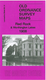
    This highly detailed map covers the area east of Standish, including Worthington Lakes.

    Features include Arley Reservoir, Worthington Reservoir, Wigan Golf Course, Arley Hall, Worthington Hall, Lancashire Union Line with Red Rock station, Kilhey Court, Water Works, Adlington Reservoir, Hollins Head Farm, William Pit, mineral railway etc. We include an 1897 timetable for the Wigan-Blackburn line on the reverse.

    The map links up with sheet 85.11 Standish to the west, 86.09 Blackrod to the east, 85.16 Haigh Hall to the south.


  • Follow this link for a complete list of our Wigan or Bolton maps.
  • You can order maps direct from our On-line Mapshop. For other information and prices, and other areas, go to The Index Page.
  • Maps in the Godfrey Edition are taken from the 25 inch to the mile map and reduced to about 15 inches to the mile. For a full list of maps for the North West, return to the North West page.
    The Godfrey Edition / sales@alangodfreymaps.co.uk / 4 March 2018