Old Ordnance Survey Maps of Bolton MBC

  • These detailed maps normally cover an area of about one and a half miles by one mile. Each map includes an introduction.
  • They are available through our On-line Mapshop

  • Here are the details of maps for Blackrod:

  • Lancashire Sheet 86.09 Blackrod 1907 - published 2013; intro by Derrick Pratt. ISBN.978-1-84784-650-1

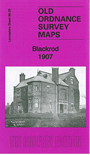
    This detailed map covers the village of Blackrod, just west of Horwich.

    Features include railway with Blackrod station, Horwich Junction, Blackrod Mill, Vale Paper Mill, Vale Bleach Works, Star Bleach Works, Green Barn Hotel, Blackrod village in detail with individual buildings shown, Council Offices, St Katharine's church, Little Scotland, Tucker's Hill, several old mine shafts, etc. A 1918 directory of Blackrod is included on the reverse.

    The map links up with Lancashire Sheets 85.12 Red Rock to the west, 86.10 Horwich (South) to the east, 86.13 Haigh to the south.


    Follow this link for a complete list of our Bolton maps.
  • You can order maps direct from our On-line Mapshop. For other information and prices, and other areas, go to The Index Page.
  • Maps in the Godfrey Edition are taken from the 25 inch to the mile map and reduced to about 15 inches to the mile. For a full list of maps for the North West, return to the North West page.
    The Godfrey Edition / sales@alangodfreymaps.co.uk / 1 February 2018