Old Ordnance Survey Maps of Bexley
We publish several maps for the London Borough of Bexley. This was formed in 1965 from the merger of the Municipal Boroughs of Bexley and Erith, Crayford Urban District, and part of Chislehurst & Sidcup Urban District.
For a summary of the county's
local government history visit This Page.
All maps are available from our On-line Mapshop.
The following titles are all taken from the OS 25" maps and reduced to a scale of approximately 14 inches to the mile.
They are extremely detailed, showing individual houses, details such as railway tracks, pathways,
pubs, factories and even minutiae such as fountains and signal posts. Each covers an area of a mile and a half by one mile, and includes an introduction.
 These are the principal maps for the London Borough of Bexley in our Kent series:
02.12 Belvedere 1895 - published 1993; intro by John A Prichard
02.15 East Wickham & Welling 1862 - published 1999; intro by Stuart Bligh
02.16 Bexleyheath (North) 1895 - published 1993; intro by Len Reilly
03.09a Erith 1864 - published 1998; intro by John A Prichard
03.09b Erith 1907 - published 2022; intro by Pamela Taylor
03.13 Barnehurst 1895 - published 1994; intro by E Thomas
08.03 Blackfen & Danson Park 1931 - published 2022; intro by Pamela Taylor
08.04a Bexley Heath 1862 - published 1994; intro by Malcolm Barr-Hamilton
08.04b Bexleyheath 1908 - published 2018; intro by Pamela Taylor
08.05 Mottingham 1861 - published 1998; intro by John Kennett
08.06 New Eltham 1895 - published 2001; intro by John Kennett
08.07a Lamorbey & North Sidcup 1895 - published 1993; intro by John Mercer
08.07b Lamorbey & North Sidcup 1931 - published 2022; intro by Pamela Taylor
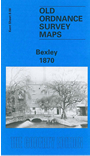
08.08a Bexley 1870 - published 1998; intro by Malcolm Barr-Hamilton
08.08b Bexley 1895 - published 2017; intro by Pamela Taylor
08.08c Bexley 1908 - published 2017; intro by Alan Godfrey
08.10 Chislehurst (North) 1895 - published 2002; intro by John W Brown
08.11a Sidcup 1908 - published 1993; intro by Malcolm Barr-Hamilton
08.11b Sidcup & Foots Cray 1930 - published 2022; intro by Pamela Taylor
08.12 North Cray 1895- published 1994; intro by Malcolm Barr-Hamilton
09.01a Crayford 1907 - published 2001; intro by Stuart Bligh
09.01b Crayford 1931 - published 2022; intro by Pamela Taylor
09.02 Dartford (North) & Crayford East - published 2022; intro by Pamela Taylor
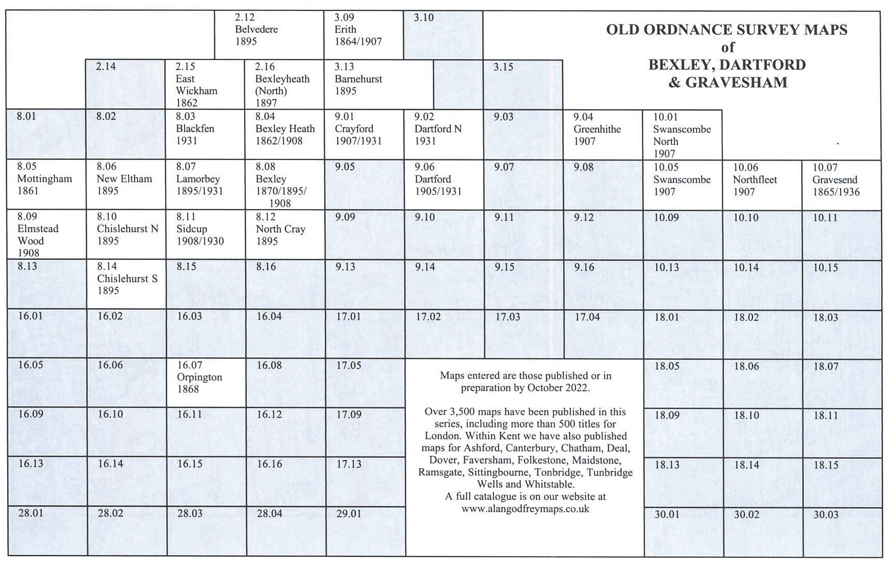
Here is an index grid to our Bexley maps.
 These are the principal maps for the London Borough of Bexley in our London series:
108 East Wickham & Welling 1894 - published 1996; intro by Len Reilly
 Most maps in the Godfrey Edition are taken from the 25 inch to the mile map and reduced to about 15 inches to the mile.
For a full list of English maps, return to the England page
You can order maps direct from our On-line Mapshop.
This list shows all our maps for the area. We try to keep a full range in print but inevitably some titles fall out of print from time to time.
These are noted in our On-line Mapshop.
Most maps in the Godfrey Edition are taken from the 25 inch to the mile map and reduced to about 15 inches to the mile.
For a full list of English maps, return to the England page
You can order maps direct from our On-line Mapshop.
This list shows all our maps for the area. We try to keep a full range in print but inevitably some titles fall out of print from time to time.
These are noted in our On-line Mapshop.
Alan Godfrey Maps, Prospect Business Park, Leadgate, Consett, DH8 7PW. Tel 01207 583388
The Godfrey Edition / sales@alangodfreymaps.co.uk / 15 July 2022