Yorks 249.07 South Featherstone & Purston Jaglin 1905 - published 2025; intro by Alan Godfrey. ISBN.978-1-78721-819-2 
This detailed map covers South Featherstone, with coverage from the railway southward to Purston Jaglin.
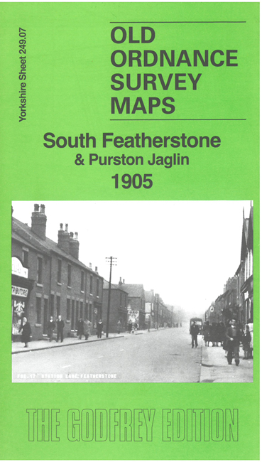
Features include railway with station, Ackton Hall Colliery, St Thomas's church, Station Lane, Manor House, Featherstone Square, Monkroyd Farm, etc. On the reverse we include a directory of Featherstone in 1889.
The map links up with sheet 249.03 North Featherstone to the north.
For other information and prices, and other areas, go to The Index Page.
Maps in the Godfrey Edition are taken from the 25 inch to the mile map and reduced to about 15 inches to the mile.
Follow this link for a complete list of our Wakefield maps; or here for the
whole Yorkshire series.
Alan Godfrey Maps, Prospect Business Park, Leadgate, Consett, Co Durham, DH8 7PW /
sales@alangodfreymaps.co.uk / 7 February 2025

 Here are the details of maps for Featherstone south: