Old Ordnance Survey Maps of Bradford

  • These detailed maps normally cover an area of about one and a half miles by one mile. Each map includes an introduction.
  • They are available through our On-line Mapshop

  • Here are the details of maps for Apperley Bridge:

  • Yorkshire 202.05 Apperley Bridge & Thackley 1906 - published 2025; intro by Martin Handley. ISBN.978-1-78721-851-2

    This detailed map covers the area from Thackley eastward to Apperley Bridge and northward to Esholt Hall.

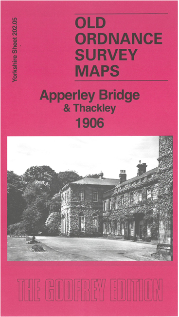
    Features include Midland Railway, Apperley Bridge station, Woodhouse Grove School, Ashdown, Apperley Lane Quarries, Nunwood, Oaklands, Esholt Hall and grounds, Leeds & Liverpool Canal, Hollins Wood, Dawson Wood, Thackley, tramway, Thorn Garth etc.

    On the reverse we include extracts from a 1912 directory together with an introduction by Martin Handley, exploring many of the features on the map.

    The map links up with sheets 201.08 Baildon to the west, 202.06 Rawdon to the east and 202.09 Idle to the south.


  • For other information and prices, and other areas, go to The Index Page.
  • Maps in the Godfrey Edition are taken from the 25 inch to the mile map and reduced to about 15 inches to the mile. Follow this link for a complete list of our Bradford maps; or here for the whole Yorkshire series.
    Alan Godfrey Maps, Prospect Business Park, Leadgate, Consett, Co Durham, DH8 7PW / sales@alangodfreymaps.co.uk / 15 April 2025